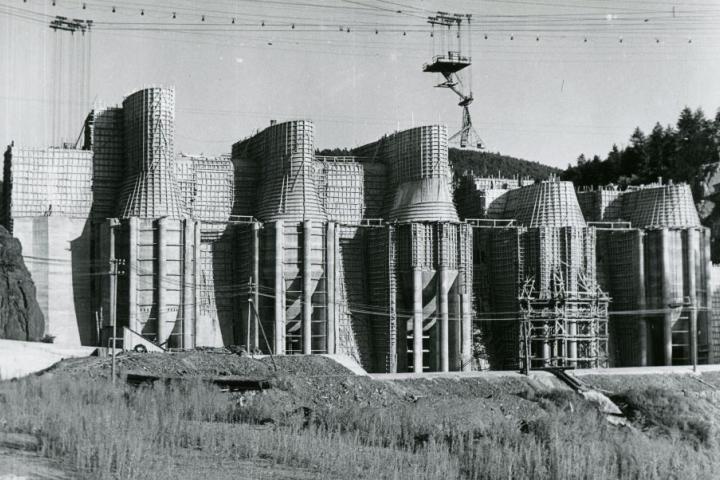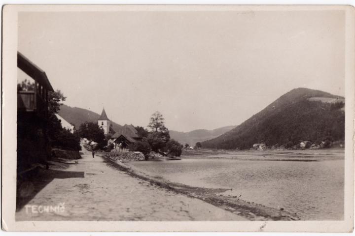
The installation focuses on the section from the source of the Vltava River to the confluence with the Berounka River and presents a unique view of the Vltava Valley and its transformation, especially in the nineteenth and first half of the twentieth century. However, visitors will also find much older manuscript maps, information about historical floods dating back to the Middle Ages, as well as information about hydrotechnical structures from the second half of the twentieth century or vanished villages. The 3D models of the Lipno, Orlík and Slapy reservoirs are unique, showing the landscape as it was before the flooding.
The project "The Vltava - Changes in the Historical Landscape as a Result of Floods, Dam Construction and Changes in Land Use with Links to Cultural and Social Activities in the Vicinity of the River" focuses on the shape of the Vltava River, especially before the creation of the Vltava Cascade. It includes not only the ongoing exhibition, but also the publication of an exclusive monograph and the creation of a web portal by the end of this year, which will make available a wide range of archival materials and will be an interesting tool for tourists, history lovers and researchers.
A big attraction of the exhibition are large 3D models of the Lipno, Orlík and Slapy reservoirs, which show the relief of the areas as they looked before the flooding. "The current water level is represented by a transparent film and underneath you can see what area has been affected by the water. Everything is complemented by LEDs that can be lit up on the control panel at the request of visitors to highlight interesting places," explains Prof. Jiří Cajthaml. In addition to the models created at the Faculty of Civil Engineering of the Czech Technical University, the exhibition is complemented by a 3D model of the original unrealised dam of the Slap dam, which was loaned to the exhibition from the National Technical Museum. Lovers of historical maps will be delighted by the cut-outs of various map works, from the oldest Altman's panorama from 1640 through manuscript maps of the 18th century to more modern map works of the 20th century. Another interesting feature is a floor print of a map of the Vltava River from the period just before the construction of the large dams. The exhibition also presents the phenomenon of rafting, which is strongly related to the Vltava.
The preparation of the materials for the exhibition was a very demanding work for the researchers spanning several years, both in terms of collecting information of various kinds, when it was necessary to visit a number of archives, museums or specific experts, and processing the materials obtained. Their publication in a web-based mapping application is the result of thousands of hours of data processing in geographic information systems.
The project "Vltava - changes in the historical landscape as a result of floods, dam construction and changes in land use with links to cultural and social activities in the river surroundings", number: DG18P02OVV037, is carried out within the NAKI II programme of the Ministry of Culture of the Czech Republic and runs from 2018 to 2022. The exhibition "Vltava - Changes in the Historical Landscape" is open free of charge every day from 9 am to 6 pm from 8 February to 7 April 2022 in the atrium of the Faculty of Civil Engineering, CTU, Thákurova 7, Prague 6 - Dejvice. The exhibition will also include guided tours.
Contact person: Lidmila Kábrtová